Sunday, August 13, 2006

Boise Area Adventures


Idaho in general has proven to have much more to offer than we'd imagined. After a single event in Sun Valley (most of which is owned, supposedly, by Demi Moore and Bruce Willis), we arrived in Boise. We made the most of the weekend. Saturday was for mountain biking in the foothills. The way up was a killer, but we were rewarded for all that work with a speedy, breezy descent.

Sunday we went whitewater rafting on the Payette River. Cascade Raft Co. showed us a great time on it's tour called "The Rush," which included Class III and IV rapids. Our guide, Dustin, was professional, passionate about the outdoors, and not hesitant to share his opinions. I liked his pro-wolf water bottle that said "Little Red Riding Hood was wrong."

Tuesday, August 08, 2006

Bikes, Bison, Bears and Bacteria Mats


Waterfall from the Broadway Bridge

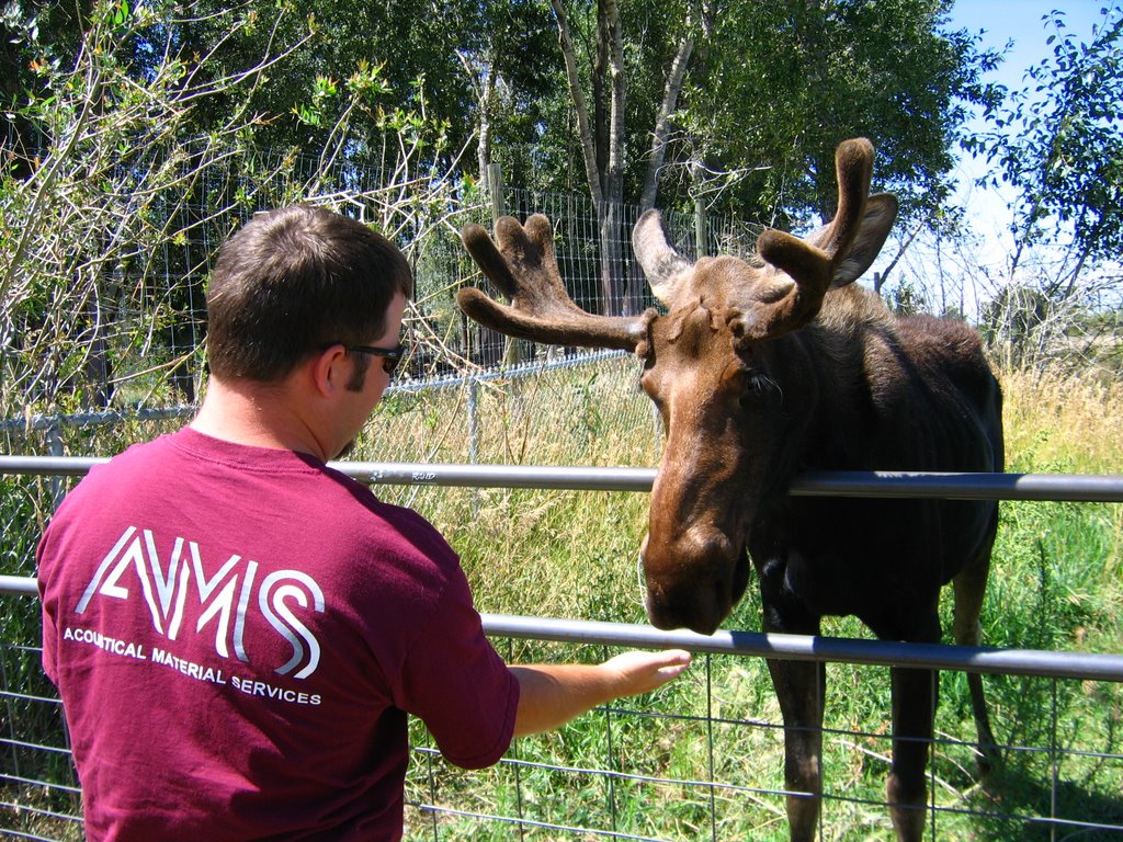
The city of Idaho Falls began with miners, trappers, fur traders and early settlers. It's location along the Snake River ensured its survival, and adds to its appeal today. The falls themselves are created by the diversion of a dam that provides hydroelectric power. The original dam was built in 1909. Idaho Falls' three hydroelectric power plants produce 50% of the electricy needed. People, including us, enjoy strolling, jogging and biking along the 6 mile Snake River Greenbelt. 20 miles north of Idaho Falls is the Yellowstone Bear World. We got up close and personal with Stiltz the moose as well as lots of other wildlife. We actually drove the truck through the different habitats for the hooved animals as well as the bear area. For some additional pics: http://s78.photobucket.com/albums/j97/d3loeber/Idaho/Idaho%20Falls/


Only 100 miles away, Idaho Falls is also a gateway to Yellowstone and Grand Teton National Parks. Grand Teton's pinnacle is 13,770 feet, but the park as a whole has twlve peaks over 12,000 feet. (For more info on Teton, visit the National Parks Service site). Elk, moose, mule deer, bison and pronghorn roam both parks, as well as black and grizzly bears. Our big sightings were bison and elk. Yellowstone is the first and oldest national park in the world. It covers 3470 square miles in three states (Idaho, Wyoming and Montana). The park is famous for its geothrmal areas including the super-famous geyser Old Faithful. We took tons of pictures. Check them out at: http://s78.photobucket.com/albums/j97/d3loeber/Idaho/Tetons%20and%20Yellowstone/


Friday, August 04, 2006

Montana Blow-Out


From Spokane to Idaho Falls, we had to pass through some seriously mountainous parts of Montana. Somewhere near Missoula (thank goodness!) we had a blow-out. Not to worry, we didn't even notice it 'til we exited the highway to find something to eat. (There are two tires next to each other on each side of the trailer.) Red's Towing Service saved the day, and, since there wasn't a single hotel room to be found in Missoula, we were back on the road in a few hours. Check out the rest of Montana's highlights, including the tiny town of Dell, pop. 35, here: http://s78.photobucket.com/albums/j97/d3loeber/Montana/

Sunday, July 30, 2006

Chinook Pass


The way to the top of Chinook Pass (5,430 feet) is designated an All American Road. It was historically used as a trading route over the Cascade Mountains. On our drive up the temperature dropped from the high 80s to the high 40s! We hadn't felt anything that cold for months, and there was snow at the top of the pass. We came back down a bit and did a geocaching hike to a waterfall a few miles above the mouth of Menatchee Creek. It was a great hike that included having to cross the creek over a fallen log.

For more photos click here: http://s78.photobucket.com/albums/j97/d3loeber/Washington/Chinook%20Pass/

Saturday, July 29, 2006

Rumble on the River


For the last 41 years, Pasco, WA has hosted an annual event on the Columbia River featuring the world's fastest race boats. Several classes of hydroplanes compete for the Atomic Cup during this action-packed weekend. Civilian and military aerial performances by a Navy F-18 Super Hornet and and F-16 Viper, among other aircraft, provided additional excitement between heats. The event generates publicity, attracts visitors and focuses attention on the water, climate and recreational aspects of the Tri-Cities area. For more pictures of the day, click: http://s78.photobucket.com/albums/j97/d3loeber/Washington/Tri%20Cities/

Wednesday, July 19, 2006

Larrabee State Park


This beautiful area is a bit over 100 miles north of Seattle, near Bellingham, WA. It includes 8,100 feet of saltwater shoreline, two freshwater lakes, tidelands and deep wooded forests from sea level to 1940 feet. There are also lots and lots of hiking trails. The one we took was supposed to lead to "Lost Lake." As far as we are concerned, it's forever lost. We walked and walked, but never found it. What we did find were lovely views of Mt. Baker, the San Juan Islands and Samish Bay; fragrant paths lined by cedars, firs and birch; moss covered rocks; curious squirrels and countless chatty birds. In case you history buffs, were wondering, the park was officially named in honor of Charles Xavier Larrabee (whose family donated the land). It became Washington's first state park in 1915. See more photos here: http://s78.photobucket.com/albums/j97/d3loeber/Washington/Larrabee%20State%20Park/

Monday, July 17, 2006

A New Hobby: The Seattle Kick-Off


Two weeks in Seattle and it's already a blur. Our events were on the slow side, but we kept busy on the weekends. While we were there, Seattle was having a heatwave. (We may have brought it with us.) It was in the upper 90s for days on end, and Seattleites were suffering. Some tried to beat the heat downtown at the Seattle Center. See more pictures here:

http://s78.photobucket.com/albums/j97/d3loeber/Washington/Seattle/

One of our USG reps is an avid hiker. She told us that the purpose of a recent hike was to recover a "geocache," a hidden treasure somewhere on the mountain. These geocaches are found using a GPS device after you visit a website (http://www.geocaching.com/) to find whether there are caches near you. Each cache has its coordinates listed, along with a description and sometimes clues. A typical cache contains a few small toys, stickers, keychains, etc., as well as a logbook to sign and date. Usually you take something out and leave something behind. After a find, you log it on the website and comment on the experience. Since then, we have become avid cachers. We've gone on a number of hikes we never would have known about, and explored parts of cities we wouldn't have seen otherwise. The photo below is from Cougar Mountain, site of an early find!


Cougar Mountain Regional Wildland Park is near the community of Issaquah not far from Seattle. It covers more than 3,000 acres, and is famous for its more than 36 miles of trails for hiking, and over 12 miles for equestrians. We did a loop that covered a number of different trails. Some of them are said to have been used 8000 years ago by Native Americans as an overland route to Bend and the Cascades. Believe it or not, we started at a Nike missile site left over from the Cold War. After World War II, anti-aircraft guns were placed on Cougar Mountain to protect Seattle and Puget Sound. They were later upgraded to Nike missle and radar sites. Other points of interest on the trails included a mine shaft used starting in the late 1800s by miners who produced coal for steamships, railroads and the city of San Francisco and Anti-Aircraft Peak. From the natural world: wetlands, salmon-spawning creeks and forest. We didn't see any of the resident mammals (black bear, black-tailed deer, bobcat, and coyote) but we did see lots of birds including, we believe, a Bald Eagle. See Cougar Mountain pics at:

http://s78.photobucket.com/albums/j97/d3loeber/Washington/Cougar%20Mountain%20Wildlife%20Reserve/

Sunday, July 09, 2006

Old Sac


Old Sac is a National Registered Landmark and 28-acre State Historic Park, on the river, in downtown Sacramento. It includes the museums, steam train excursions, the Delta Queen (which used to travel daily to San Francisco in the late 1920s), shopping, restaurants, and memories of the area in the time of the gold rush.

Tuesday, July 04, 2006

If you're fond of sand dunes...

The 4th of July weekend was a great escape to Old Cape Cod. We arrived in Boston only a half hour late after having lost an engine on the redeye from San Francisco and being diverted through Detroit. After a quick side trip to visit grandma, we crossed the Bourne Bridge.


It was a great weekend of nature, exploration, family and fun in real Cape style: beaches and lighthouses, kayaks, lobster rolls. On the 4th, we head to Boston for a homestyle barbecue at Sally's. Sally always has the best meals, and she should since she works hard to put things together! We feasted on tasty appetizers that could have been the whole meal, beer can chicken, amazing grilled vegetables, pasta salads, bread, and much much more. All this was followed by a great view of downtown Boston's fireworks from high in the Arboretum. Check out more pictures from the weekend at http://s78.photobucket.com/albums/j97/d3loeber/Cape%20Cod/

Sunday, June 25, 2006

Dodge/Savemart 350


Our first race of the season was at Infineon Raceway, Sonoma, CA. This track is one of the two road courses the Nextel Cup drivers run each season. The remaining 34 races are on oval tracks. This track is a 2-mile course with 12 turns, both left and right. It’s demanding on drivers because there is more braking and shifting involved than usual. The race is 350 miles, and took just under 4 hours. Cheech Marin was the Grand Marshall.

Before the race began, Donny and I represented USG in presenting a $5000 check to Casey Mears, who gained the most positions during last week’s race in Michigan. We looked great up on the big screen, by the way. It was both fun and educational to have access to the garage and pits before and during the race. Matt Kenseth started in 9th position today, and finished 18th. That’s still somewhere in the middle, but not nearly as well as he’s been doing in general this season. Jeff Gordon, in the Dupont #24 car, won the race. A word of advice to anyone who might attend a race at Infineon though: Remember where you parked. We ended up taking two shuttles then walking for more than an hour through the rolling fields in search of our truck.


For more pics- http://s78.photobucket.com/albums/j97/d3loeber/San%20Francisco/Infineon%20Raceway/

Saturday, June 24, 2006

Wednesday, June 21, 2006

Big Ol' Trees


Moving inland from the coast, we followed the Russian River. There were sunbathers, kayaks, canoes and a host of other recreational activities for a sunny June afternoon. The river is dotted with small hamlets inhabited by a mix of the rich and fabulous, bohemian artists and their followers, and migrant laborers. Right in the middle, near the town of Guerneville, is the Armstrong Woods State Reserve. Our hike was a 5.6-mile journey with an 1100-foot climb and lots of switchbacks. Among the ancient redwoods, we saw the 1400 year old Armstrong Tree and the 310-foot tall Parson Jones. We also saw two deer, lots of squirrels and birds, and a couple of hawks.

Check out more pics- http://s78.photobucket.com/albums/j97/d3loeber/San%20Francisco/Armstrong%20Redwoods%20State%20Reserve/

Tuesday, June 20, 2006

Contrasting Coasts


Growing up on Cape Cod I have a certain idea of what the beach is supposed to look like. Sand stretches as far as you can see, flat except for rolling dunes filled with beachgrass and driftwood, beach plum and saltspray rose. The sea is deep blue or emerald green. Surfers are lucky to catch anything big enough to challenge them, unless there's been a storm. The north Pacific always impresses me. The rocky cliffs are not gentle. The waves crash instead of roll. Much of the land surrounding the Sonoma Coast is still farmland, with cows wandering the craggy headlands above and occasional harbor seals in their own world far below.

Check out more photos- http://s78.photobucket.com/albums/j97/d3loeber/San%20Francisco/Sonoma%20Coast/

Monday, June 19, 2006

Got Grapes?

We did a lot of initial research on the best way to get a feel for Napa Valley. There were bus tours, bike tours, shared shuttle vans, rented limos/SUVs, and the Wine Train (which doesn’t even let you off). A sense of independence, adventure, and a tight budget dictated we choose the drive-yourself-and-figure-it-out route.

Napa County is known as one of the finest viticulture regions in the world. There are two roads that form a circuit through a large number (over 200) of vineyards. Our first stop was the Chimney Rock Winery in the Stag’s Leap District.

Our next stop was Rutherford Hill. We had a nice walk around, smelled a few flowers and went on our way.

We then stopped at Calistoga's Old Faithful Geyser. Whether it is natural, and just opened when domeone was drilling a well, or whether the it was created by someone drilling a well around the turn of the century, it's now considered by many to be one of the three "Old Faithfuls"
in the world (designated as such due to constant, predictable eruptions). While we were there it performed about every 15 minutes, spouting scalding water about 50 feet into the air. The water comes from an underground river, which boils, expands and builds up pressure after flowing over molten magma deep in the earth. It may even be used in the prediction of earthquakes.

After the geyser, we head to Clos Pegase Winery, which had lots of cool sculptures. Further along, at Sterling Vineyards, we took a tram ride up to the winery. They had things set up for a self-guided tour (educational, and from grape to glass), followed by a tasting. We bought a bottle of 2005 Malvisia Bianca. We had an early dinner at Mustard's Grill in Napa--great food featuring fresh local ingredients. Tasty.

Back at the hotel we were greeted by the field-full of long-eared Jackrabbits next door.

For more pictures of this lovely day, click here http://s78.photobucket.com/albums/j97/d3loeber/San%20Francisco/Napa%20Valley/

Tuesday, June 06, 2006

Believe

The new Shamu show at Seaworld. We also caught the dolphin show.


Check out some other photos
http://s78.photobucket.com/albums/j97/d3loeber/San%20Diego/Sea%20World/

Monday, June 05, 2006

Memorial Day at the Zoo

Check out some photos from the world famous San Diego Zoo.

Make sure you look at both pages.
http://s78.photobucket.com/albums/j97/d3loeber/San%20Diego/Zoo/

Saturday, May 27, 2006

Mount Lemmon


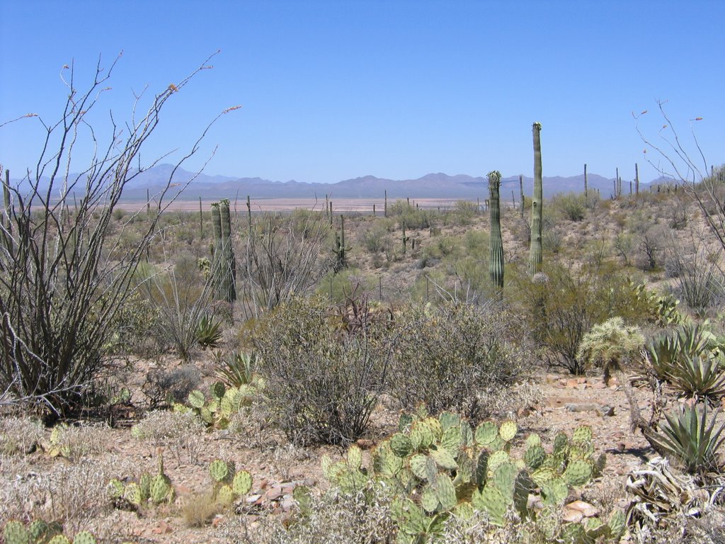
Sometimes there’s a good reason for the road less traveled being less traveled. We decided to take the back way up to the top of Mt. Lemmon, 9157 feet. The pavement ended almost immediately, and one of the few signs we saw was at the beginning: Mt. Lemmon 50 miles. The unpaved road quickly deteriorated into more of a wide path of dirt, rocks and sand. As we got higher, the road narrowed even more, and each curve was tighter than the last. Need I mention the truck is an extended bed with a poor turning radius? About three hours later we had passed a dozen cows, four horses and two guys on ATVs. The desert landscape slowly transformed into forest, as aspens and pine replaced cacti. If the signs about recent fire activity and flash flood hazards weren’t unnerving enough, we had also reached bear country. The last 14 miles took just over an hour. Just before we finally saw a few campsites and reached pavement at last, we caught up to the ATV-ers pulled over to the side surveying the landscape. “So, you made it!?” one of them called out as we passed, as if they had placed bets on whether we were ever to be heard from again. Once on the peak, the only thing keeping us from descending was that we couldn’t get the truck back out of 4-wheel drive (quickly solved by consulting the manual) and that the speedometer had stopped working (that inexplicably fixed itself). The front of Mt. Lemmon was beautiful! It looked more like Colorado than Arizona. We must have stopped at a dozen pull-offs before the 60 degree temperature we enjoyed on the mountaintop crept back up to 90 as the sun went down.

For more mountain scenes click here- http://s78.photobucket.com/albums/j97/d3loeber/Tucson/Mount%20Lemmon/

Biosphere 2

Biosphere 2 is a project initiated by a Mr. Bass. The part of it most people have heard of it “The Man Project,” in which four men and four women successfully lived within this closed environment where everything was used and recycled. They grew crops, had animals (the pigs were soon slaughtered, but the goats and chickens were used for their products), and maintained the machinery that controlled their air, humidity and pressure. After two years inside, the project was deemed a success. Later, Columbia University entered into an agreement to use the facility for research, which they did for a number of years. We were told the University reneged on the agreement, leaving Biosphere 2’s future up in the air. They have not been able to find anyone else who can afford to take Columbia’s place so far.

Biosphere 2 contains a rainforest, desert, savanna, marsh and ocean (a million gallons of seawater complete with a living coral reef). Each is a biome, a self-sustaining community of living organisms. Underneath, a 500-ton stainless steel liner separates it from the Earth. The white domes through the glass in the photo above are air-volume control devices containing a giant membrane to accommodate changing air pressure/temperature.

For a better "Lung" photo and others click here- http://s78.photobucket.com/albums/j97/d3loeber/Tucson/Biosphere%202/

Friday, May 26, 2006

Pima Air and Space Museum


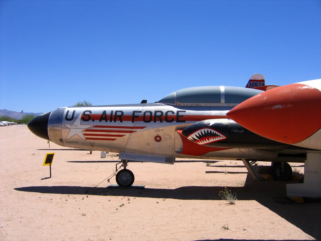
Some people had mentioned the airplane graveyard on the east side of Tucson. The dry, sunny weather makes this a good spot for long and short-term storage of military and commercial planes. There are thousands and thousands on both sides of the highway, though less, we were told, than before 9/11. The world’s largest privately funded aerospace museum, The Pima Air and Space Museum is in the middle of this area. There are five hangars to explore with exhibits from the Wright Brothers’ first flight to modern experimental aircraft. Outside are acres and acres of helicopters, attack aircraft, transport units, reconnaissance planes, rescue vehicles, commercial, NASA and military planes. Highlights were a walk through the Kennedy/Johnson Airforce 1, and SR-71 Blackbird, which holds the record of the world’s fastest plane (that they want known publicly at least). At around 2200 mph, it can go coast to coast in just over an hour.

For more aero photos click here- *FYI there are 2 pages

http://s78.photobucket.com/albums/j97/d3loeber/Tucson/Pima%20Air%20and%20Space%20Museum/

Thursday, May 25, 2006

Arizona-Sonora Desert Museum


Tucson has more museums than you might imagine. One of the more interesting outdoor examples we found was the Arizona Sonora Desert Museum. It’s kind of a cross between botanical garden, modern zoo and hiking trail. All of the habitats, especially on the outer, unpaved trail, seemed very natural and open. Some were designed with invisi-wire that made it feel like you were walking right next to the animals. We came around one corner and a coyote was lying under a tree yawning right in front of us. Wolves jogged around in circles waiting for lunch. Javelinas nosed around the shrubbery and gathered under a stone bridge where there was shade and a bit of water. There were many other examples of indigenous plants and animals, and docents were posted here and there providing more specific information and giving presentations. We got some interesting facts about the agave cactus this way. Later, we sat in on a presentation by some herpetologists about venomous snakes and lizards of the desert. The Gila monster looked pretty in salmon and black until she pooped on the demonstration table, and the rattlesnakes didn’t stop rattling the whole time.

For some widlife photos click here- http://s78.photobucket.com/albums/j97/d3loeber/Tucson/Arizona%20Sonora%20Wildlife%20Museum/

Saturday, May 20, 2006

Paseo del Volcan


A few miles west, we drove along the Paseo del Volcan to hike among what’s left of Albuquerque’s volcanoes. Lava once flowed from a 5-mile fissure in the earth’s surface, creating the striking geological features we see today. There are five cones.


More pics http://s78.photobucket.com/albums/j97/d3loeber/Albuquerque/Volcanoes/

Petroglyph National Monument


New Mexico is home to one of the largest collections of petroglyphs in North America. We chose a hike through Rinconada Canyon, about 2.5 miles through the sand dunes, with volcanic rock rising high on either side. The canyon is part of the Santa Fe Formation, though to be up to 25,000 feet thick in some parts. Pueblo and other tribes lived in adobe villages along the Rio Grande and used this area for hunting, gathering, some farming, and cultural and religious activities. The petroglyphs are mostly human-like and animal figures, spirals and geometric designs left by the Pueblo Indians, along with some crosses and animal brand markings left by Spanish explorers and others who settled here later. There is much less graffiti here than in El Paso, but a number of the drawings have been damaged by bullet holes. We even found some shell casings on top of a volcanic hill nearby.


Mas fotos http://s78.photobucket.com/albums/j97/d3loeber/Albuquerque/Petroglyph%20National%20Monument/

Monday, May 15, 2006

Mission Trail


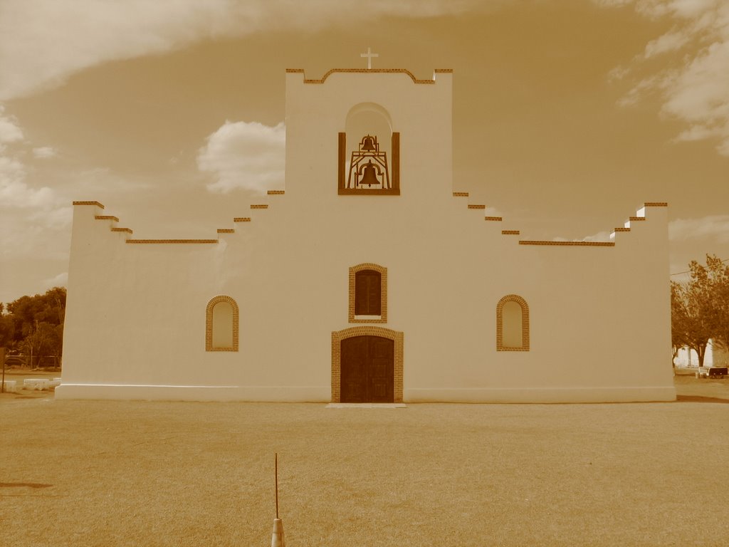
After our day at Hueco Tanks we decided to hit the mission trail. The oldest active missions in the US are in El Paso: Ysleta, Socorro and San Elizario. The three are Spanish built churches established in the last 1600's.

For more shots click here http://s78.photobucket.com/albums/j97/d3loeber/El%20Paso/Missions/

Hueco Tanks


The Hueco Tanks State Historical Site is about 30 miles northeast of El Paso. We got a preview of the general area when we arranged to go to Casey’s (a nice fellow who races his dragster at the El Paso Speedway, and also happens to be the local distributor of Sunoco race fuel). Casey and his family (see photo) got a big kick out of filling our car from his private stash. He didn’t even want to charge!

Hueco Tanks refer to the hollows in the rocks that fill with water when it rains and historically has provided a source of water for whoever inhabits this area at the moment. Archeologists believe that ancient peoples visited here as long ago as 10,000 years. Signs of the Paleo Indians such as tools and arrowheads have been found here. Around 600 AD people began to practice agriculture, and live in small settlements. One group, who probably lived here around 1150, the Jornada Mogollon, left most of the petroglyphs. The over 200 painted masks are part of their art. Later, the Spaniards arrived in the El Paso area, and they along with members of the Apache, Kiowa and Tigua tribes left their marks here as well. In the mid 1800s there was a stop here on the Butterfield Overland Mail Route. People stopped to get food and change out their mules. These days, people visit the area for rest, relaxation and reflection. Unfortunately, many of the petroglyphs have been damaged by graffiti. To try to protect things as much as possible, the park limits the number of visitors. Reservations are required on weekends, and guests must watch an orientation video on the importance of preservation. Enjoy more pics of the beautiful scenery, animals and plants we saw.

For more photos click here http://s78.photobucket.com/albums/j97/d3loeber/El%20Paso/Hueco%20Tanks/

Sunday, May 14, 2006

Texas Mountains???


El Paso, TX desert blooms. Taken in the Franklin Mountains state park. We went for a long hike in the afternoon. We found a few shallow caves which were very handy for taking a break out of the sun. When we got back down to the truck the exterior temp was reading 99 degrees.


Below is a link to our other photos from the day. We suggest using the slideshow feature on the left of the page.
http://s78.photobucket.com/albums/j97/d3loeber/El%20Paso/

Sunday, April 30, 2006

It's a tough life, but someone's got to live it...

South Padre Island, TX, another beach to drive.


Where the road ends.

For more photos click below. Try the slideshow button on the left.

http://s78.photobucket.com/albums/j97/d3loeber/South%20Padre/

Laguana Madre Creatures


So we are on South Padre Island, TX. We are having a stroll on a boardwalk by the bay and come upon a sign (the first pic). Yeah you know what we were thinking, sure, alligators, yeah right! We got to the end of the boardwalk where the alligators were supposed to be hanging out and all we spotted was a few birds and a cool turtle. Then, out of the blue, we hear a lady clapping and calling "Pete." It took a couple minutes before we realized she was calling the alligator. It turns out that Pete knows his own name and responds to clapping. He swam over to us and got out of the water to show himself off in all of his glory. After a while, we left him to finish his afternoon nap.

50 Years of Rock-n the Bayou

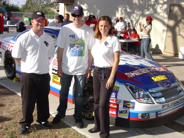
ROCK ON! WEST Team with #17 Driver Matt Kenseth
Donny suits up for USG Sheetrock plant tour
Random Trampling...but who sat on who?
No turtles were harmed in the taking of this photo, but the rabbit and sausage jambalaya last night was delicious! I gar-un-tee.
Thursday, April 27th was a celebration in honor of the 50th Anniversary of the USG New Orleans Plant. Attendees included current and former employees and their families (some who had worked at the plant for over 40 years). We were there with the #17 show car, as was driver Matt Kenseth. The weather was beautiful, the atmosphere was festive, and a good time was had by all.

Sunday, April 23, 2006

Another Tough Day at the Office


Corpus Christi, TX. We spent our Saturday lounging on the beach at the Padre Island National Seashore. The seashore is 65.5 miles of pristine coastline, the longest in the country. As the tide came in, the body surfing definitely got better and we spent a long time in the water. In an attempt to take a different route home, we ended up driving about 8 miles on the beach on our way to Bob Hall Pier and the highway. On our 4 wheeling adventure we encountered may fishermen, some of them clothed and others not. Once we got close to the pier there were lots of large groups on the beach having cookouts and playing horseshoes and other games.

After a long day at the beach we headed over to one of the local favorites Snoopy's Pier. Dinner was followed by dessert next door at the ice cream shop called Scoopy's. We felt like kids again, since it was so hot, it was impossible to eat the ice cream fast enough to keep it from making a total mess. All in all, it was a great day, and much needed.

Wednesday, April 19, 2006

Minute Maid...Not Just OJ

Inside Minute Maid Stadium, Houston, TX
Another view.
From the outside, downtown Houston.

Our local USG rep took us to an Astros game this week. They won 8-7 against the Milwaukee Brewers. Minute Maid Stadium is right near downtown, Houston. Opened in 2000, it has natural grass and a retractable roof.

When the home team hits a home run, a 50,000 pound replica train runs 800 feet across the low roof rail on the west side of the ballpark. This ties in to the ballpark's location adjacent to Union Station, the city's former train station, dating back to 1911.

Maguire's Easter Brunch


Easter was spent driving from Dallas to Houston, but before we left, we had a great brunch at Maguires North Dallas (www.maguiresdallas.com). The seafood omlette and filet and eggs are highly recommended. Mmmmm. Yummy. The Easter bag, by the way, was courtesy of Greta L. (aka Mom) and was filled with goodies including Easter Egg playing cards. I kicked Donny's butt in gin with them.

Friday, April 14, 2006

A True Redneck


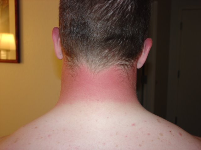
We obviously were not prepared for the climate change from Milwaukee/Chicago to Dallas. (Don't worry, Greta, it looks worse than it is.) We've finished the first two weeks of the new tour, and not a drop of rain! It's been sunny and in the high 80s the whole time. Shopping this weekend will definitely include sunscreen. We leave for Houston, where we are assured it will be even hotter, on Easter.

The first two weeks were pleasantly uneventful. We've been enjoying the hospitality of USG reps in the area (dinner, drinks, USG branded shirts and things). For those who aren't quite sure what this tour is all about, and what it is, exactly, that we do, here it is in a nutshell:

About four times a week (3-5 depending on travel) we take the ROCK ON! unit (See trailer photo below) to the business we have on our schedule. These are mostly distributors, wholesale centers, etc. of USG products. In advance, local USG reps have requested an appearance of the NASCAR racecar we are traveling with. They coordinate this for their best customers as sort of a perk, or added encouragement. For the businesses, it's a great event for their customers (mostly contractors). They have posters advertising the visit, and send out invitation postcards.

Onsite, we unload the car, and fold out the stage that makes up one section of the trailer. This creates a room for people to enter and take a look at some USG product samples (Durock cement board, join compound, etc.). We also have two kiosks where they can enter their name and some basic information and get a premium (hat, bandana, carpenter's pencils, etc.) We usually start up the car two or three times during an event (4-6 hours). The hosts usually provide a breakfast or lunch for attendees. So far, the best have been Cowtown of Fort Worth for their delicious barbecue, complete with several kinds of meat, salads, beans, cornbread and dessert. Someone from one of the other Dallas locations has a ranch, and killed a cow for the occasion. Those were some TASTY burgers (sorry vegetarians). Oh, and yesterday at C&C Wholesale, we had breakfast tacos (egg, egg with chorizo, or meat with sides of guacamole, salsa, etc.) I could have eaten 10.

After the event is over, we pack it all up and leave. There is some pretty basic reporting/recapping to do later, plus an upload of the data from the kiosks...Nothing too complicated, though. USG hopes to gain some brand recognition from this tour, using their sponsorship of NASCAR to draw attention. They are also using it as a way to thank current loyal customers. Unlike some other promotional tours, this is not about the hard sell. USG sells many of its products as fast as they produce them. People use the Sheetrock brand name like they do Q-Tip or Kleenex. It's USG's BRAND. The generic product is drywall. Got it? Hope this gives an idea of what it is we do. More to come....

Tuesday, April 04, 2006

I Finally Got To Drive Part 2


Today was USG Rock West's first event. We had a turn out of 60 or so at Building Specialties in Frisco, TX. Of the 3 team's cars our car is by far the loudest. We think it's because it's a speedway car and the other two are short track cars.